|
Veteran Weather Station www.gympieweather.com |
|
| 15-11-05
Storm Report: Copyright © 1998-2003 
Thunderstorm pictures taken in the Cooloola Region : |
|
|
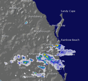
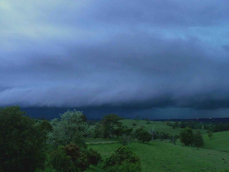
Tuesday afternoon (15-11-05 6:00pm ) there were a few cumulus clouds forming a line to the South, the line kept building and slowly moving North East toward Gympie. The radar loop below gives the picture. Note that it was the second line of storms that became severe. |
|
|
|
|
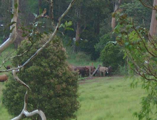
The
stock became aware of the impending danger and gathered in the corner of the paddock. If lightning had struck in the vicinity, it would have had the potential of killing all these animals.
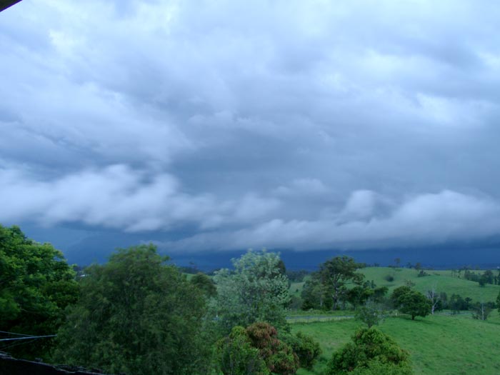
By 6:50pm it was very obvious that we would get strong wind and heavy rain from this system... actually it was starting to look quite nasty. |
|

|
|

|
|
|
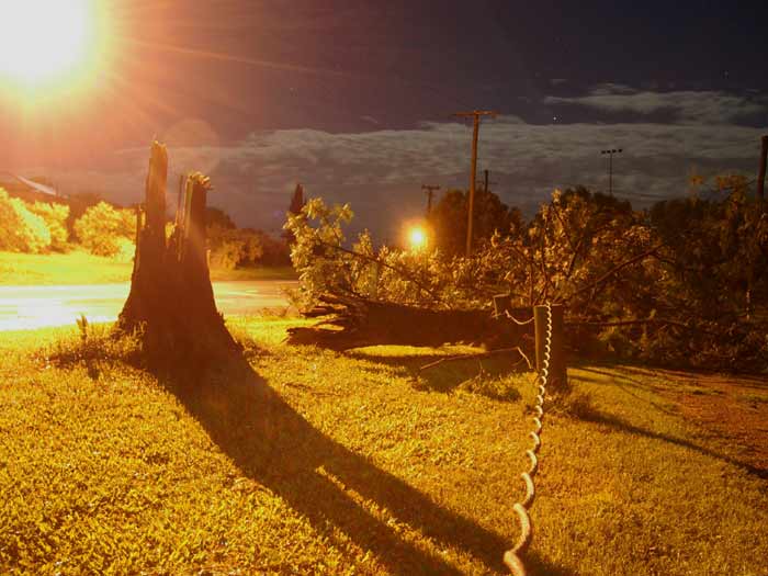
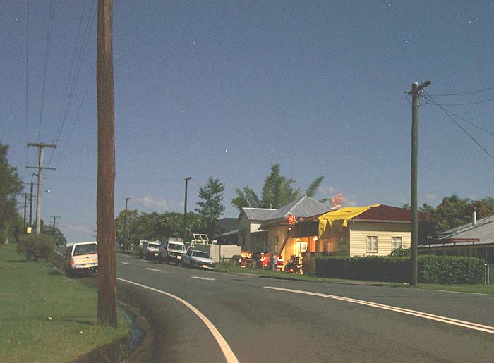
Between 7:00pm and 7:15pm the Gympie AWS had recorded 47mm of rain, the Automatic Weather Station is located to the NW of the city but, the brunt of the storm seemed to be to the South, this was quite a rainfall rate considering the wind was blowing nearly horizontal. I went into Gympie without my camera... silly me! I thought that I would capture some footage of the storm's path in the morning, but I couldn't wait that long so I drove back out to Veteran to get it. It was about 11:00pm by the time I started taking the photos.
|
|
|
|
|
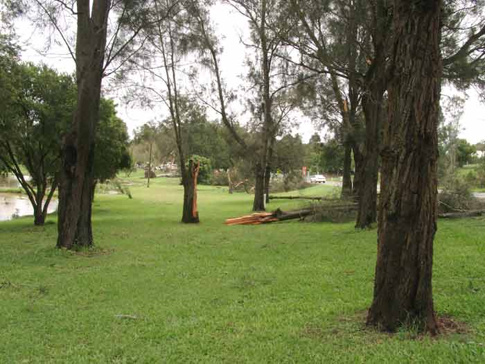
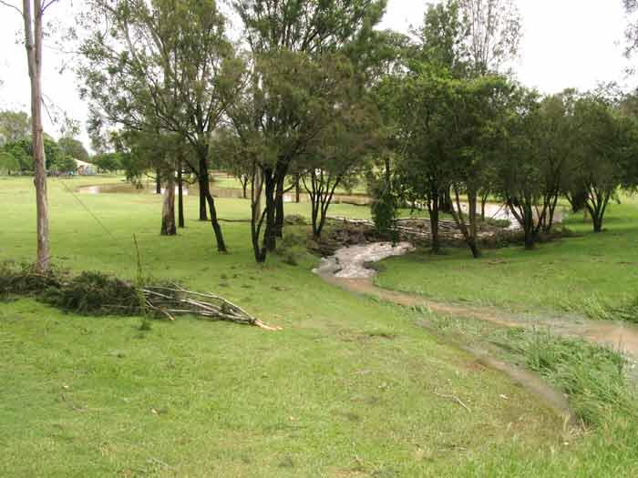
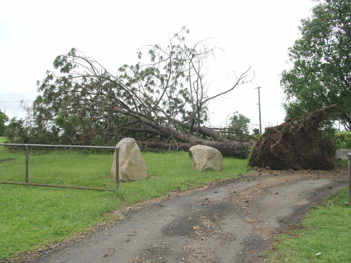
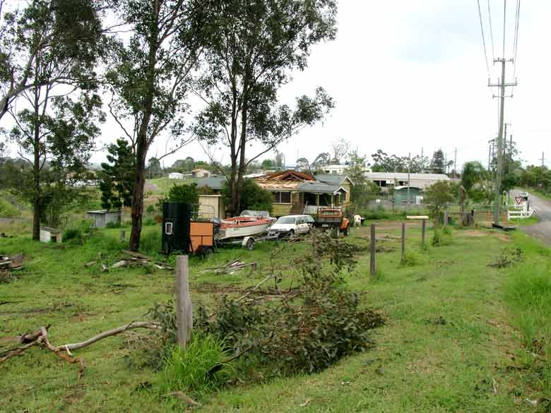
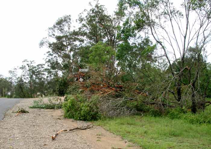
An uprooted tree at the "Duck Ponds" at Monkland
I had to be extra careful in the dark due to the tangled and fallen power lines around. |
|
|

|
|
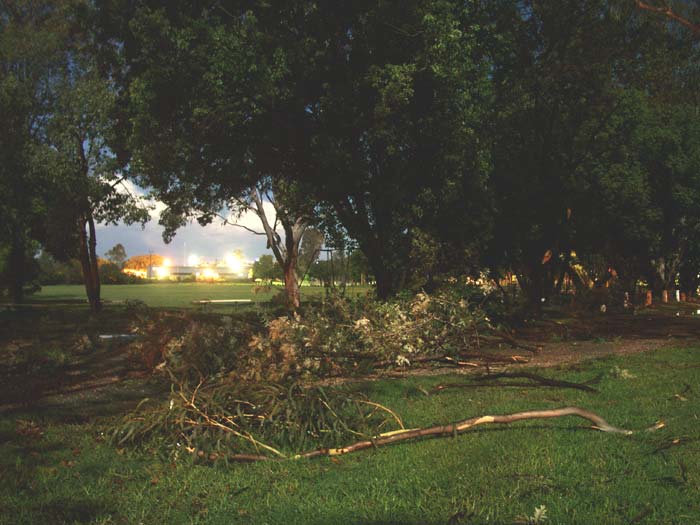
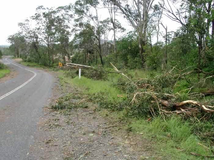
The Emergency Crews were hard at it around midnight, these photos were taken on Horshoe Bend. Gympie was without power for most of the night, the Cooloola Community Private Hospital were relying on a backup generator for most of the night. |
|

|
|
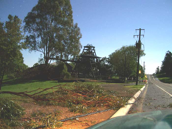
| Now for the morning stint... Just as well I took some of the photos through the night as work was well underway this morning to clean up the mess. Many thanks to all the workers that toiled through the night. | |
|
|
| Duck-Pond area at Monkland... | |
|
|
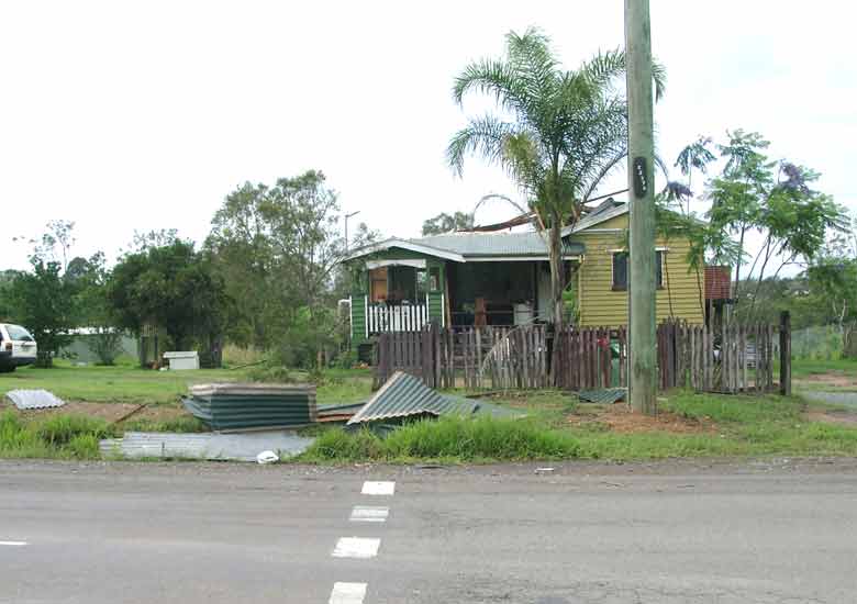
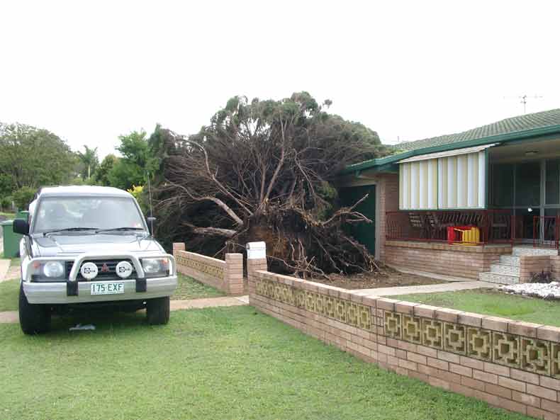
| House damage on Hall Road... | |
|
|
|
|
|
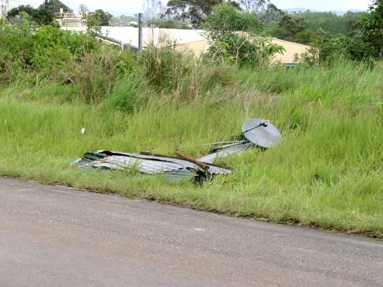
Anyone for Satellite TV? Noosa Road and Hall Road intersection |
|
|
|
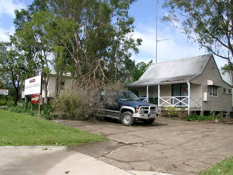
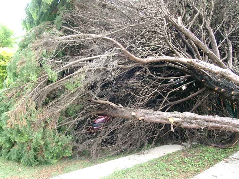
| I was talking to the occupant of this home in town and she told me how it took so long for her dad to come to her aide when the tree had come down. He just couldn't get there very quickly at all due to all the debris on the road. As I got talking to her and took a couple of photos she said, "There's a car under that tree and one in the garage" I looked in disbelief, but upon further inspection there it is... a shiny red car! | |
|
|
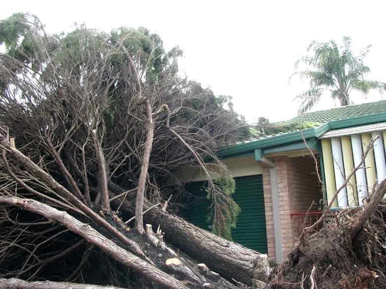
| Then there was this tree... Uprooted... On the House... and Whoaa... ON the CAR! | |
|
Disclaimer: Do not base any
important decisions on any information that you may receive from this
site. Weather data from this site is a representation of current and
past conditions in this local area and includes links to other sites. |
|