|
Veteran Weather Station www.gympieweather.com |
||
| 5th
March-04 Weather Report: Copyright © 1998-2004 
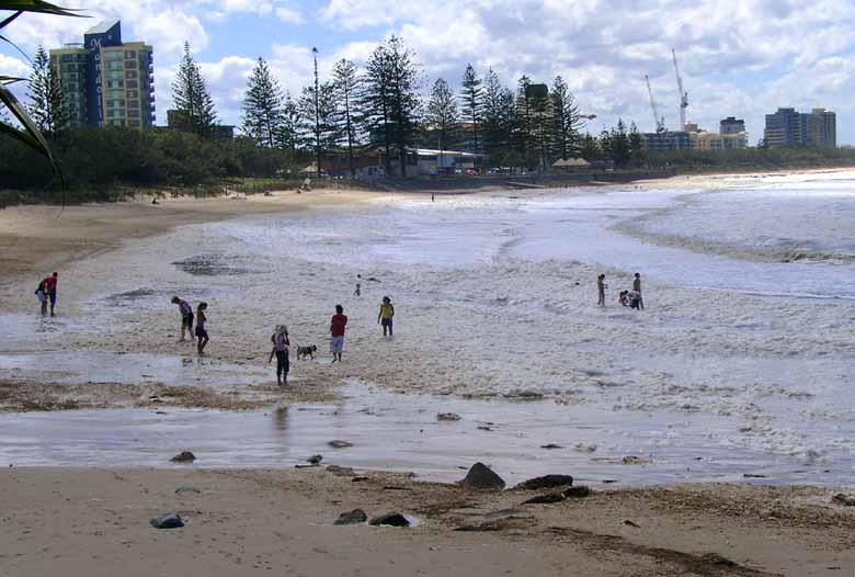
On the morning of Friday 5th March
most people were watching, waiting and wondering why the Bureau of
Meteorology hadn't declared a Tropical Cyclone watch or Warning for the
Cooloola coastal region as a 994 HPA low moved West South-West towards
Hervey Bay. In fact it was rather confusing as the SEWS (Severe
Emergency Warning Signal) was broadcast on radio and television in the
region quite a few times from about 11:00am on Friday. It appears that
this low was on the borderline of being a category 1 tropical
cyclone and an East Coast Low. The system was actually a complex one
consisting of two lows, the most eastern low heading on a southerly
course but when combined with a large high pressure
system down south it was tightening the pressure gradient and packing
winds of 50 knots with gusts up to 120 km/h on the Sunshine Coast. The
low pressure system developed in a monsoonal trough in the Coral Sea on
Tuesday and moved SW toward Hervey Bay where the western low of 995 HPA crossed the coast at
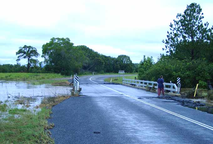
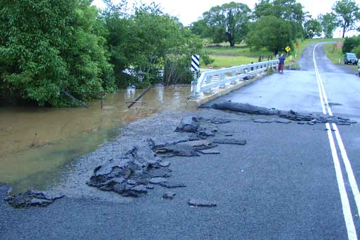
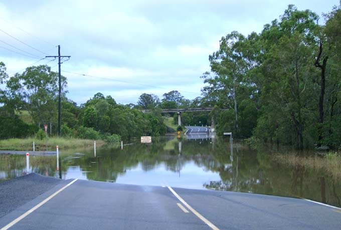
8:00pm on Friday night. The heavy rain was enough to cause
minor flooding in the shire, it washed a couple of cars away as well as
doing some damage to farms and homes. This was Gympie's first
significant flood in four years, the Kidd Bridge was closed and under
water on Saturday and Sunday. The Mary River's swollen waters peaked at
11.2 metres at 9:00am on Sunday, this was the first time that the bridge
had been closed due to flood since the Mary peaked at 9.55 metres in May
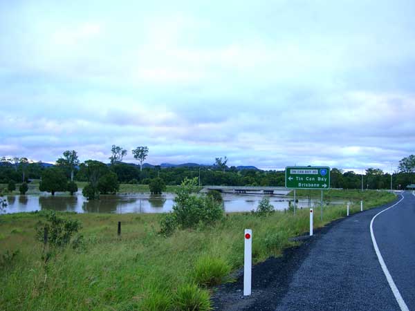
2000. The Bruce Highway remained open throughout the duration, but Tin
Can Bay and Rainbow Beach were out of the question on Saturday due to
the flooded bridge over Tinana Creek. I believe that some motorists had to go to Tin Can Bay via Maryborough and then
down the Cooloola Highway, this was a 160 km trip as against the normal
80 km. |
||
|
|
|
|
|
This was the fourth flood event since the flood of the century on February 10 1999 when the Mary River peaked at 21.95 metres. There will be many more floods and many more storms to follow this one, when will we see another really big one? The weather always keeps us entertained and alert... Ted Uebergang |
||
|
Disclaimer: Do not base any
important decisions on any information that you may receive from this
site. Weather data from this site is a representation of current and
past conditions in this local area and includes links to other sites. |
||